
Why low-altitude work keeps tripping teams up
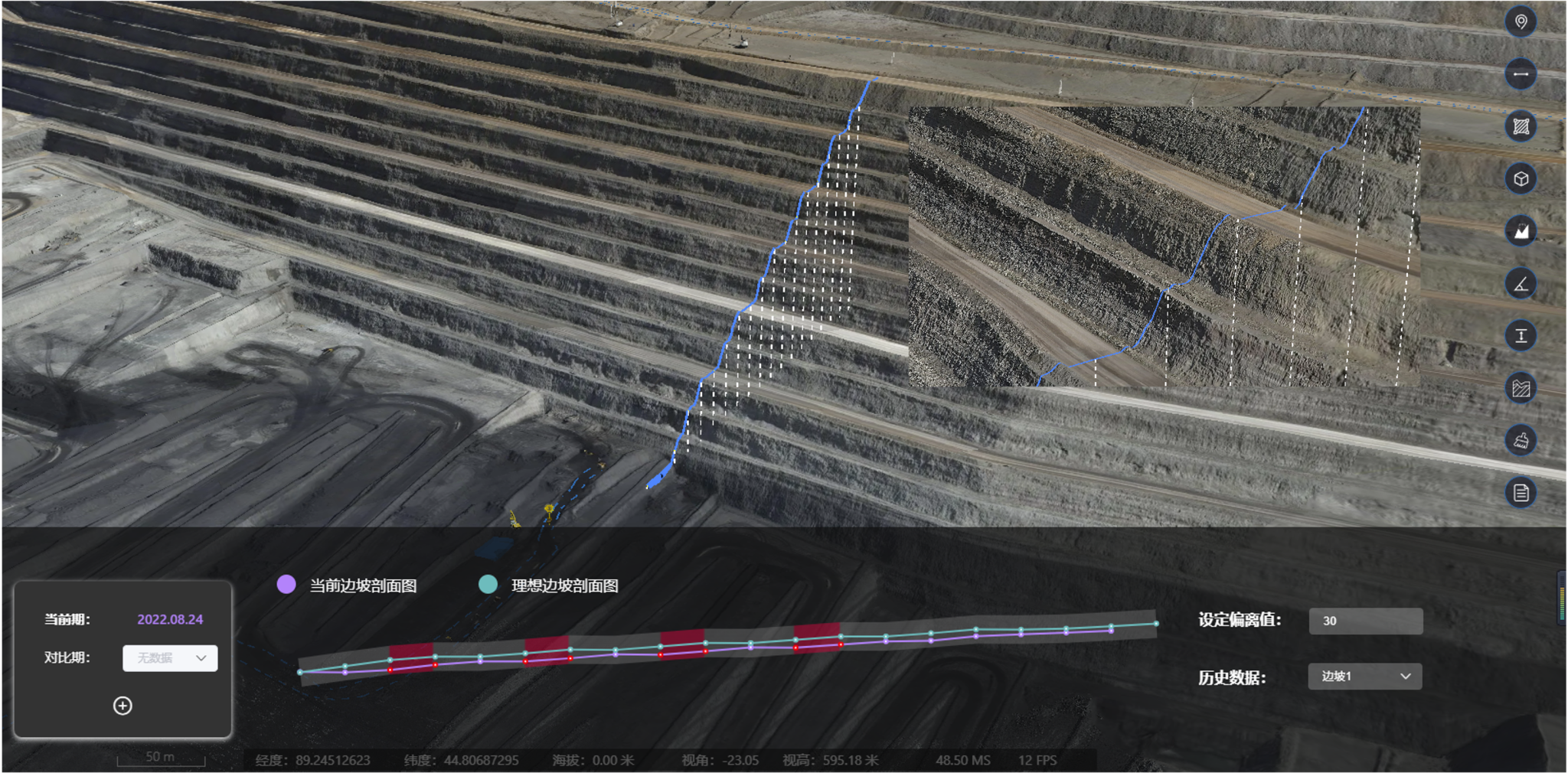
I’ll cut to it: running sensors low over a site that’s changing by the hour makes folks miss measurements, waste flight time, and lose trust in their maps. Around open-pit benches or stockpile yards, small elevation changes and moving machinery will mess up positioning unless you’ve got tight georeferencing and a solid mining monitoring system feeding reliable data. That problem’s what drives the rest of this piece — we’ll lay out where the failures happen and how to stop ’em without wasting crew hours or tossing out your survey plan.
Where the trouble shows up on the ground
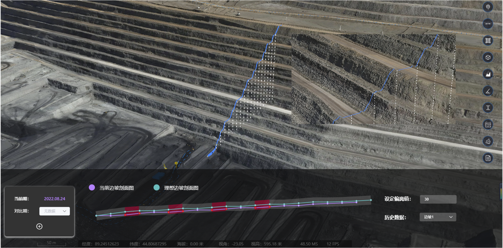
Low-altitude operations run into three recurring snags: sensor occlusion, poor geolocation, and stale models. I’m talkin’ about UAV flights that get clipped by dust, LiDAR scans that miss a berm, or photogrammetry runs without control points — all of which produce a noisy point cloud that don’t match your plans. In places like the Pilbara iron-ore fields, operators learned fast that small errors in digital surfaces lead to costly stockpile miscounts. Those real-world hits proved that tech without process ain’t gonna cut it.
Practical fixes that actually change results
Start with a checklist you’ll actually follow. Calibrate sensors, schedule flights for consistent light, and use RTK or PPK for positional control. Pair photogrammetry and LiDAR so one fills the other’s blind spots. Feed all that into a digital twin layer — a live model that handles updates as the site shifts — and you’ve got your baseline for decisions.
Operational playbook: step-by-step
Here’s a short playbook that crews can run without a PhD in remote sensing:
– Pre-flight: verify GNSS lock, clear NOTAMs, and mark temporary ground control where heavy activity will be.
– Collection: alternate low-altitude grids with higher-overlap corridors; use redundant passes over critical assets.
– Post-processing: align LiDAR point cloud and photogrammetry meshes in a GIS, apply noise filters, and tag areas of uncertainty.
Do these things every shift and you’ll cut rework. The steps are simple, but they require discipline — and a platform that accepts mixed inputs without manual wrangling.
Common mistakes and how to dodge ’em
Teams often skip control points, trust factory calibration forever, or export raw models straight into reports. That’s where the trouble lives — bad inputs make bad outputs. Avoid the trap by automating quality checks, documenting a short-change SOP for each site, and keeping a log of environmental conditions. — If wind gusts ruined a pass, mark that pass as tentative instead of folding it into your stockpile numbers.
Comparing options: do-it-yourself vs. integrated systems
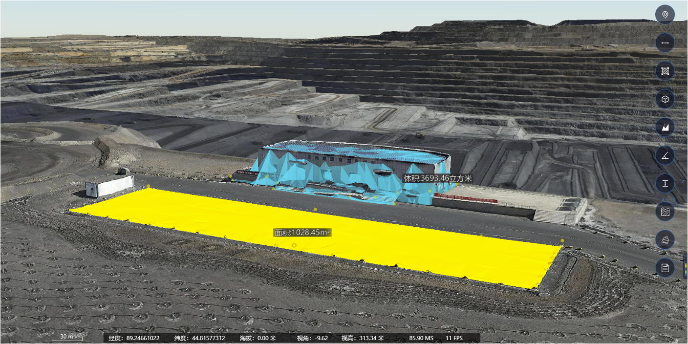
DIY stacks can work if you’ve got time and a skilled surveyor. But integrated solutions that combine UAV telemetry, LiDAR, photogrammetry, and a managed digital twin reduce human error and speed turnarounds. Look for systems that support BIM overlays and real-time discrepancy alerts so planners can act same-day on what changed.
Closing: three golden rules for picking the right tools
1) Data fidelity over flashy features — choose solutions that report uncertainty and keep raw sensor traces. 2) Interoperability — make sure your software accepts UAV logs, point clouds, and GIS layers without a clunky import. 3) Operational fit — match the tool to your crew’s workflow, not the vendor’s demo. Follow these and you’ll get consistent outputs that planners trust.
Those rules reflect real needs from sites that shift under your boots, and they point straight to why a cohesive approach matters on the ground. Icecypress Technology pulls those threads together into a platform that’s built for updating models fast and keeping teams in sync — practical, predictable, and ready when the workday flips. —