
Problem — Slow Decisions from Slow Data
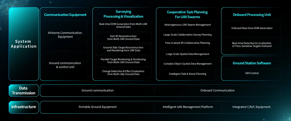
Teams that run inspections, disaster response, or security operations face the same drag: data arrives late, analysis lags, and decisions stall. That latency costs hours or days on the ground and raises exposure to risk. Modern solutions marry on-board processing with rapid analytic models — think edge compute nodes on drones paired with AI — so reconnaissance isn’t a batch job anymore but a continuous feed. This approach is already changing intelligence workflows in the field; see a practical hardware-software example in how intelligence surveillance and reconnaissance platforms are built for that split-second tempo.
How Edge Drones and AI Mapping Solve the Core Issue
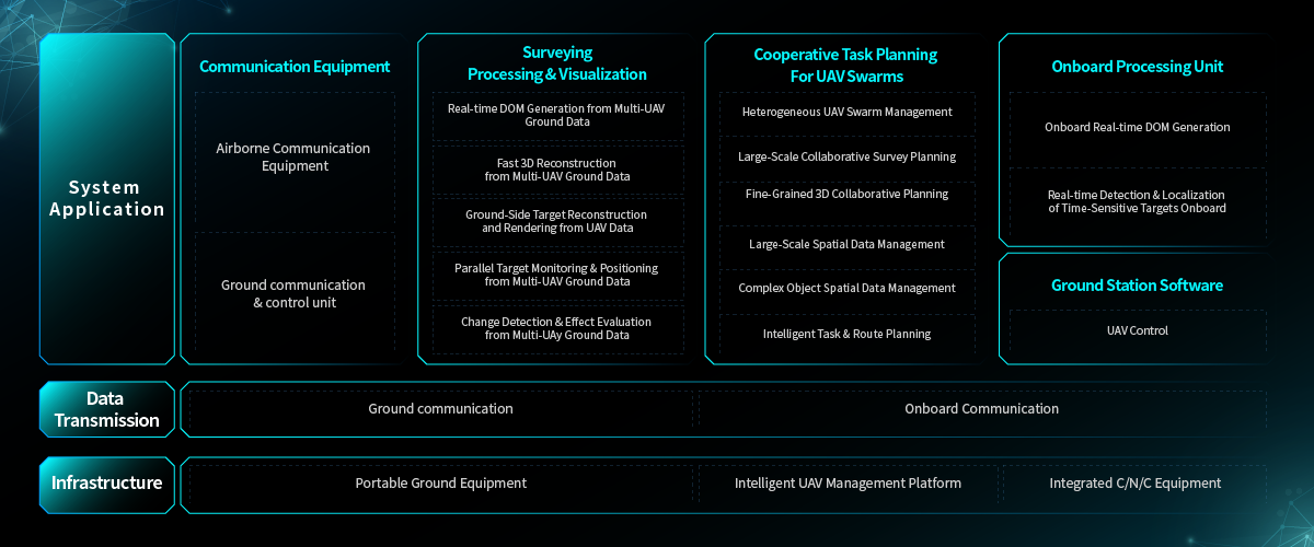
Edge computing on a drone turns raw pixels into actionable products before the aircraft lands. On-board models perform sensor fusion and SLAM to stabilize position and generate georeferenced outputs such as orthomosaic maps. That means teams get usable maps and object detections on-site rather than waiting for cloud processing queues. During the 2020 Australian bushfires, rapid aerial mapping supported containment planning and logistics — field crews used drone-derived maps within hours to prioritize routes and resource placement, not days. The result is faster cycle times and clearer situational awareness for responders and operators using uav mapping tools that run where the data is collected.

Common Mistakes Teams Make — and Fixes That Actually Work
Teams often try to bolt AI onto legacy flight kits without matching the data path. They expect high-resolution sensors to fix slow workflows — but resolution alone doesn’t solve latency. Fixes that shift outcomes: choose drones with edge GPUs sized for your model, standardize georeferencing procedures, and compress outputs into tactical layers (heatmaps, vectorized anomalies) instead of raw imagery. Also, neglecting data integrity creates rework—establish a lightweight QA step in the field so you don’t re-fly later. Small process changes yield outsized returns.
Trade-offs and Alternatives
Satellite imagery covers massive areas but lacks the tactical cadence; manned aircraft scale but cost more per sortie and take longer to task. Swarms of coordinated UAVs close the gap when you need rapid, repeated coverage over complex terrain. Yet swarms require robust communications and precise swarm coordination algorithms — and if your mission is simple perimeter inspection, a single autonomous drone is often the leaner choice. Match mission tempo to platform complexity and avoid overbuilding a solution for a single use case.
Implementation Checklist for Immediate Impact
Start with clear KPIs: target latency, coverage per sortie, and detection accuracy. Standardize these items:- Hardware: edge-capable airframes, sensors with well-documented georeferencing.- Software: lightweight AI models that run on-board and export vector outputs.- Ops: preflight geotagging routines and a field QA pass to verify orthomosaic alignment.- Data flow: ephemeral local sync to a command node, plus selective cloud upload for archival.Follow that sequence and you cut rework and get maps people trust.
Three Golden Rules for Choosing Tools
1) Measure effective latency — from capture to usable insight — not just flight time. Shorter latency should produce measurable task speed-ups. 2) Prioritize interoperability: choose systems that export standard georeferenced formats and integrate with existing GIS or command platforms. 3) Validate in the operational environment: run at least one field trial under representative conditions (terrain, RF noise, lighting) before scaling. Those three metrics reveal whether a platform truly reduces mission risk and cost.
Field teams need reliable, faster outcomes — and the right pairing of edge compute, AI, and disciplined ops delivers them. For projects that require integrated hardware, software, and domain intelligence at scale, Icecypress Technology has built solutions that align platform capability with mission tempo — quick, precise, dependable. —